PACIFIC
OCEAN
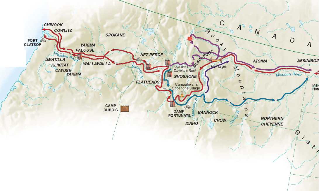
The all-water route that Columbus had envisioned—from the Atlantic Ocean to China and the East Indies—was blocked by the landmass of the Western Hemisphere. But over the next few centuries, explorers dreamed of finding a river-route across that landmass. The Missouri River, which originated far to the west, seemed promising. In the fall of 1802, President Jefferson asked the Spanish minister whether his government would take offense if a small group of Americans explored the sources of the Missouri River. The expedition, Jefferson assured the Spaniard, would have no purpose other than "the advancement of geography."The minister coolly replied that such an adventure "could not fail to give umbrage to our government."After the meeting, the diplomat promptly alerted his superiors in Madrid that Jefferson,"a lover of glory,"sought to find a water route to the Pacific, thus facilitating American settlement of the region.
The Spaniard was right. Several months after his meeting with the Spanish minister, Jefferson sent a secret message to Congress. In it he requested an appropriation of $2,500 for an expedition to determine whether the Missouri River con-nected,"possibly with a single portage,"to the Western (Pacific) Ocean. Jefferson's belief in a water route to the Pacific via the Missouri was based on several sources.
In 1784 Peter Pond, an employee of the North West Company, prepared a map based on reports by the company's fur traders (see accompanying Pond map).They told him that the Missouri River originated within the "Stony (Rocky) Mountains."Beyond them lay the Naberkistagen River, which emptied into the South Sea (presumably the Pacific Ocean). Inspired by such reports, Alexander Mackenzie, a Scotsman in the fur trade, crossed the Continental Divide farther north and, after an easy portage, came to the Fraser River, which flowed into the Pacific. Although the raging
Fraser was unsuited for commercial navigation, Mackenzie believed that a satisfactory route to the Pacific could be found elsewhere. In 1801 he published a book advancing this hypothesis and urged Great Britain to develop the route that would ultimately join the Atlantic and the Pacific.
Jefferson, alarmed by British interest in the Northwest, immediately ordered a copy of Mackenzie's book. It arrived at Monticello in the summer of 1802. Jefferson and Lewis poured over the maps. They compared Mackenzie's account with a map compiled by Jedidiah Morse. Morse's map, too, suggested that the source of the Missouri nearly connected with the River of the West (see Morse map). Lewis's mission was to find the easiest route to the Pacific.


 World History